vessel 538009040 IMO: 9410997, vesseltracker.com
Vessel 538009040 IMO: 9410997,
MMSI: 538009040 callsign: size: x

Find the position of the vessel 538009040 on the map. The latter are known coordinates and path.

marine traffic ship tracker show on live map

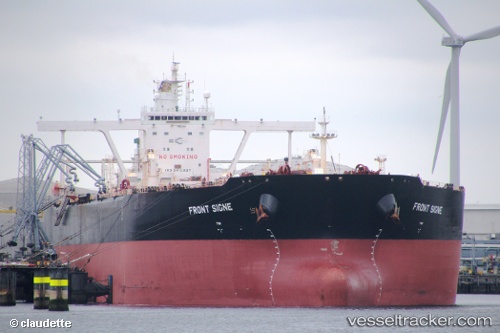
The current position of vessel 538009040 is 1.25153 lat / 103.934 lng. Updated: 2024-05-09 17:20:39 UTC
Payload_mass:
297007 tonne
Gross tonnage:
156991
Service entry:
2010-01-01T00:00:00Z
Details:


Last coordinates of the vessel:
UTC, 1.25097, 103.929, course: 89, speed: 0
UTC, 1.25275, 103.93, course: 154, speed: 0.2
UTC, 1.25277, 103.931, course: 175, speed: 0.1
2024-05-09 17:20:39 UTC, 1.25153, 103.934, course: 234, speed: 0

Track of the vessel in the last 14 days


Most frequent ports a vessels calls at 538009040 (538009040):

Sirri Island, traffic: 5
Jazireh-Ye Sirri, traffic: 4
Sambu, traffic: 3
Fujairah, traffic: 2
Kribi, traffic: 1
Malacca, traffic: 1
Mina Al Ahmadi, traffic: 1
Mina Az Zawr, traffic: 1
Angra Dos Reis, traffic: 1

Link to the map:


Find another ship

538009040 (538009040) last ports (portcalls and passsages)

Kribi | 2023-12-24 14:36:22
Malacca | 2023-01-01 05:39:16
Sirri Island | 2022-12-20 23:14:58
Fujairah | 2022-12-14 23:59:43
Sambu | 2022-11-20 00:36:13
Mina Az Zawr | 2022-11-03 23:18:04
Sirri Island | 2022-11-02 03:06:37
Fujairah | 2022-10-31 11:55:16
Angra Dos Reis | 2022-09-26 07:02:11
Sambu | 2022-05-23 11:08:47
Sirri Island | 2022-05-11 14:07:44
Sambu | 2021-12-17 03:35:14
Sirri Island | 2021-12-04 20:23:28